


NASA-ISRO joint mission NISAR to launch on Wednesday, countdown for GSLV-F16 launch begins
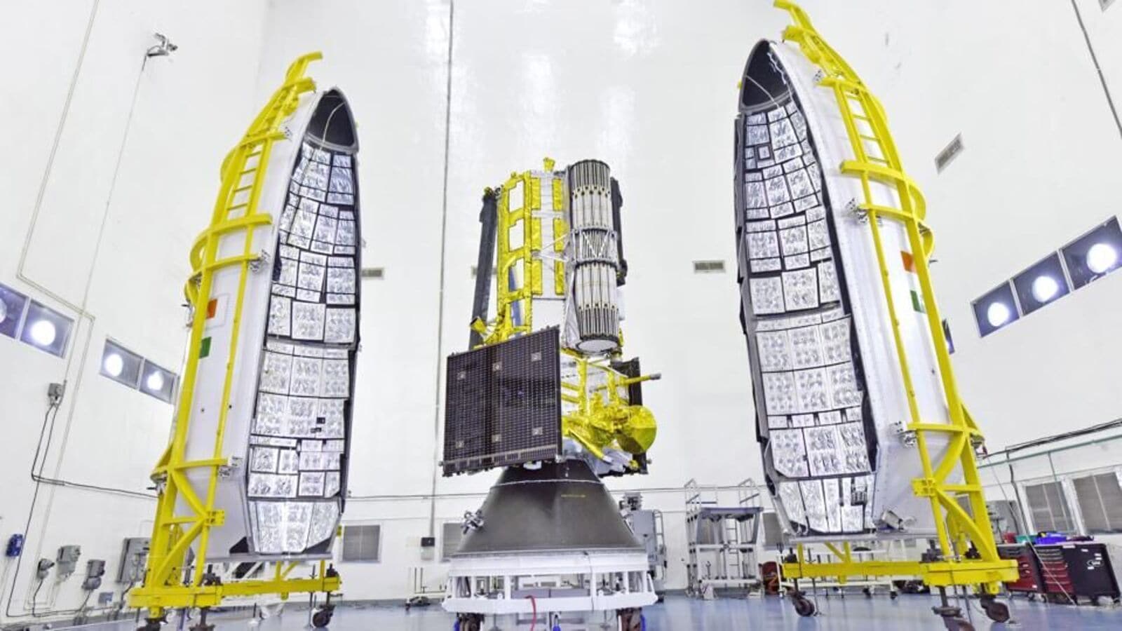
The 27.5-hour countdown for the launch of the NASA-ISRO Synthetic Aperture Radar (NISAR) satellite commenced at 2:10 pm on Tuesday, the Indian Space Research Organisation (ISRO) confirmed. The satellite is scheduled to lift off aboard the GSLV-F16 rocket at 5:40 pm on Wednesday from the Satish Dhawan Space Centre in Sriharikota.
This launch marks the 102nd mission from the Indian spaceport and is significant for being the first Geosynchronous Satellite Launch Vehicle (GSLV) mission directed to a Sun-synchronous polar orbit.
Jointly developed by NASA and ISRO over more than a decade, the NISAR mission aims to deliver high-resolution, dual-band radar data that will help monitor changes in the Earth’s land and ice surfaces. The partnership was given renewed momentum following discussions between leaders of the United States and India earlier this year.
GSLV-F16, standing at 51.7 metres, is a three-stage launch vehicle and this flight represents its 18th mission. It is also the ninth time the rocket will operate using an indigenous cryogenic upper stage.
Once launched, the satellite is expected to reach a designated orbit approximately 740 kilometres above Earth after a 19-minute flight. Unlike previous Indian earth observation satellites that primarily focused on national territory, NISAR is designed for global monitoring.
The satellite carries two radar systems: a NASA-provided L-band and an ISRO-supplied S-band Synthetic Aperture Radar. Together, they enable fully polarimetric and interferometric imaging, capable of capturing detailed measurements of land displacement, ice sheet movement, and ecosystem dynamics every 12 days.
NISAR will implement a SweepSAR mode, a technique that combines high resolution with a wide imaging swath. This feature is expected to significantly improve the mapping of land changes over time, including coastal erosion, glacier shifts, and agricultural transformations.
ISRO highlighted that this mission broadens the scope of international data-sharing and cooperation, building on previous joint efforts such as Chandrayaan-1 and astronaut collaboration during Axiom Mission 4 aboard the International Space Station.
With NISAR, both space agencies intend to support scientific research in areas such as natural disasters, sea-level rise, and climate change, using radar imaging tools suited for long-term environmental observation.
The launch is set to take place from the second launch pad, roughly 135 km from Chennai, with final preparations currently underway.