


ISRO-NASA’s NISAR mission to launch on July 30: 5 key things about ‘most advanced’, ‘most expensive’ satellite
NISAR is the first-of-its-kind joint Earth observation satellite by the Indian Space Research Organisation (ISRO) and the National Aeronautics and Space Administration (NASA).
It is scheduled to launch into space at 5:40 p.m. on July 30 from Sriharikota, Andhra Pradesh. The ISRO has already shared a YouTube link where the launch will be live-streamed. The live streaming will begin at 5:10 p.m.
NASA says it is the “most advanced Earth-observing radar satellite we’ve ever launched.”
What is NISAR? Why is it important for India? And how will it help? Here’s all you need to know about the ISRO-NASA joint satellite.
What is NISAR?
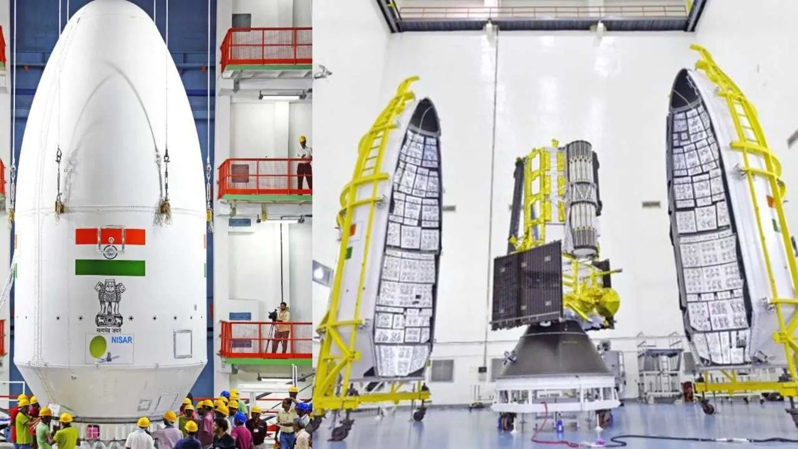
ISRO’s GSLV-F16 – an Indian rocket – will launch NISAR, the first joint Earth observation satellite by ISRO and NASA, from Sriharikota on July 30.
NISAR is short for ‘NASA-ISRO Synthetic Aperture Radar’.
It is a unique earth observation satellite. It will observe earth with a swath of 242 km and high spatial resolution, using SweepSAR technology for the first time.
The NISAR mission will have a minimum mission lifetime of three years.
“It’s the most advanced radar satellite ISRO and NASA have ever launched,” NASA said.
What will NISAR do?
This powerful satellite will track changes on land and ice, from areas at risk for landslides and earthquakes to shifting glaciers and ice sheets.
It will track the movement of land and ice surfaces down to a fraction of an inch, giving us key data on earthquakes, volcanoes, glaciers, and more.
The satellite will further monitor soil moisture, crop growth, and drought effects to help farmers make informed decisions all season long.
NISAR will scan the entire globe twice every 12 days, providing high-resolution, all-weather, day-and-night data, “sampling Earth on average every 6 days for a baseline 3-year mission.”
Most areas will be imaged four-six times per month, with exact repeat of the orbits at 12-day intervals.
It can detect even subtle changes in Earth’s surface, such as ground deformation, ice sheet shifts, and vegetation dynamics.
“The mission will also support many critical applications, including sea ice monitoring, ship detection, storm tracking, soil moisture changes, mapping and monitoring of surface water resources and disaster response,” the space agencies said.
One of the goals of the mission is to “increase the utility, accessibility and discoverability of NISAR data by a broad community.”
Why NISAR mission is important
NISAR’s data can help people worldwide better manage natural resources and hazards. The mission will offer help in areas such as agriculture, preparation for, and response to disasters like hurricanes, floods, and volcanic eruptions.
It will also provide information for scientists to better understand the effects and pace of climate change. “It will empower scientists, researchers and policy makers with vital incites,” ISRO said.
The NISAR mission will also add to “our understanding of our planet’s hard outer layer, called its crust,” NASA explained.
“As the mission continues for years, the data will allow for better understanding of the causes and consequences of land surface changes, increasing our ability to manage resources and prepare for and cope with global change,” NASA said.
Besides, this mission symbolises a leap towards sustainable living and informed disaster resilience.
“NISAR is not just a satellite, it’s a symbol of global unity, scientific excellence and hope. It promises to safeguard out future by helping humanity live more wisely with nature,” the space agencies said.
“From farmers and scientists to disaster responders, NISAR will empower Earth observation like never before,” ISRO said.
The satellite mission also marks a new chapter in the growing collaboration between the two space agencies – ISRO and NASA.
How will NISAR work?
NISAR uses a sophisticated in formation-processing technique known as synthetic aperture radar to produce extremely high-resolution images, NASA explains.
The radar penetrates clouds and darkness, allowing NISAR to collect data day and night in any weather.
Over the course of multiple orbits, the radar images will allow users to track changes in croplands and hazard sites, as well as to monitor ongoing crises such as volcanic eruptions.
“The images will be detailed enough to show local changes and broad enough to measure regional trends,” NASA said.
NISAR has two radar instruments — an S-band system provided by ISRO and an L-band system provided by NASA — to provide high-resolution data to “help decision-makers, communities, and scientists monitor major infrastructure, agricultural fields, and movement of land and ice surfaces,” NASA said.
Milestone of firsts and key features
1. First dual-band radar satellite: NISAR is the first satellite mission to collect radar data in two microwave bandwidth regions, called the L-band and the S-band, to measure changes of Earth’s surface, including movements as small as centimeter.
2. First GSLV to SSO: It will be the first time that GSLV-F16 will inject a satellite into a 743 km Sun-synchronous orbit (SSO) with an inclination of 98.40.
3. First ISRO-NASA EO mission: This is the first space collaboration between NASA and ISRO for an Earth Observation (EO) satellite mission.
4. World’s most expensive satellite: NISAR, weighing 2392 kg, has a price tag of $1.5 billion, making it the most expensive Earth observation satellite to date, the Indian express reported.
5. Data storage and distribution: The radars will generate about 80 terabytes of data products per day over the course of NISAR’s prime mission. That’s roughly enough data to fill about 150 512-gigabyte hard drives each day. The information will be processed, stored, and distributed via the cloud — and accessible to all.